HOA Managed Lakes (Canals)
Encircled by “Works of the District,” the Coco Wood Lakes canals fall outside SFWMD and LWDD maintenance programs. Canal expenses are covered by a waterfront-only, equal-share surcharge that is added to each quarterly assessment.
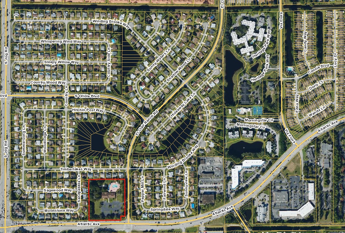
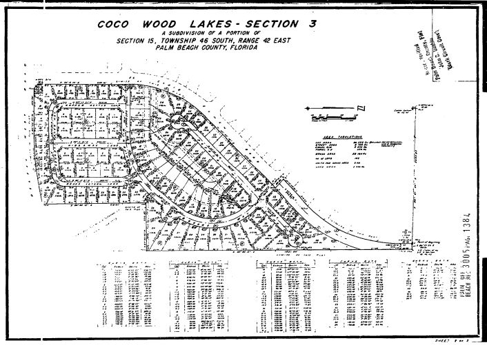
This screenshot from the Palm Beach County GIS Ownership Records viewer shows parcel boundaries (yellow). The clubhouse is a separate parcel highlighted in red. Around the nearby lake, the parcel lines radiate into/through the waterbody in wedge-shaped segments, reflecting an older/private-lot parceling pattern rather than a single “common area” lake tract. In many newer subdivisions, stormwater lakes/ponds are instead platted as dedicated water management tracts/common areas with required maintenance access easements, and post-construction maintenance responsibility typically shifts to the HOA (or a contracted manager).2 3 4
Our Lakes (Canals)

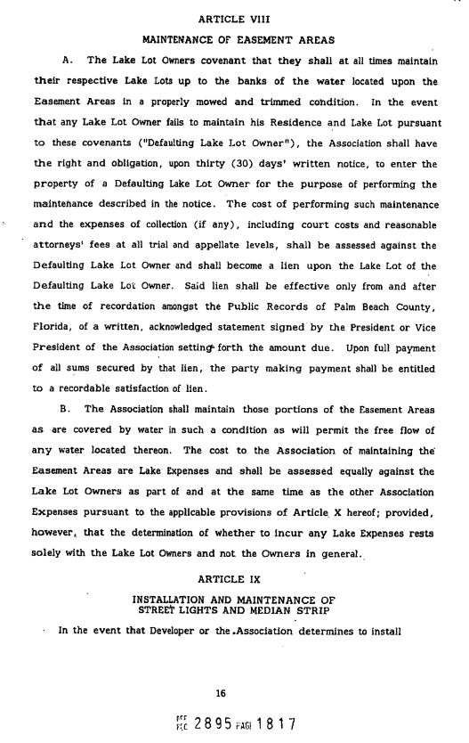
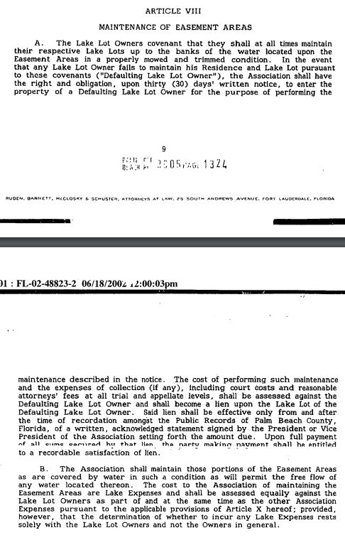
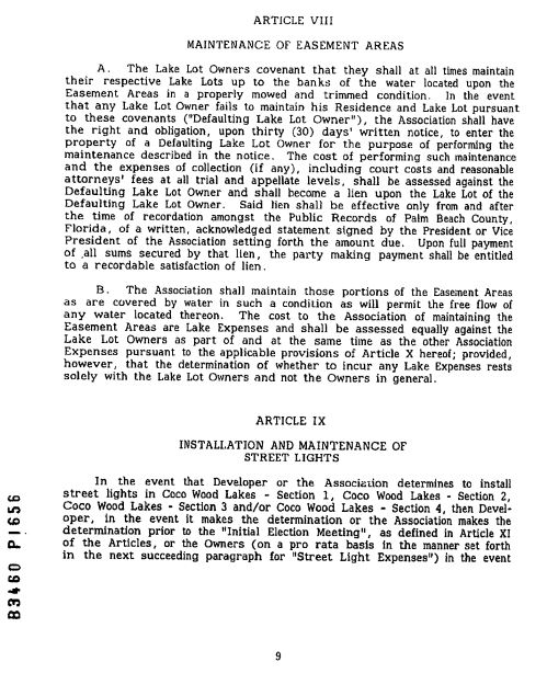
Maintenance of Easement Areas
Community Surveys
- Palm Beach County ULDC — Lake Easements & Tracts (Article 11.B.8.A) — Quotes: “placed entirely within a water management tract dedicated or deeded to an acceptable entity…” and “lake maintenance easements… shall be established over common areas only, and shall not encroach residential lots.” (See “Stormwater Management and Maintenance Access Rights,” p. 43.)
- St. Johns River Water Management District — HOA stormwater responsibility — Quote: “after construction of permitted systems… legal responsibility for maintaining these systems typically is passed to a homeowners’ association…”
- Lake Worth Drainage District — Stormwater pond maintenance responsibility — Quotes: “After developers complete construction… the permit and the legal responsibility… are typically passed on to… association.” and “The association is responsible for labor and expenses for keeping the system functional…”
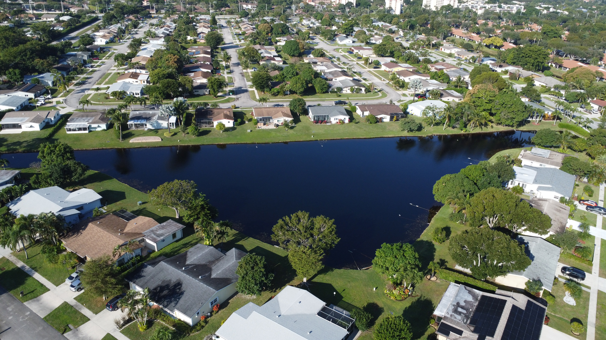
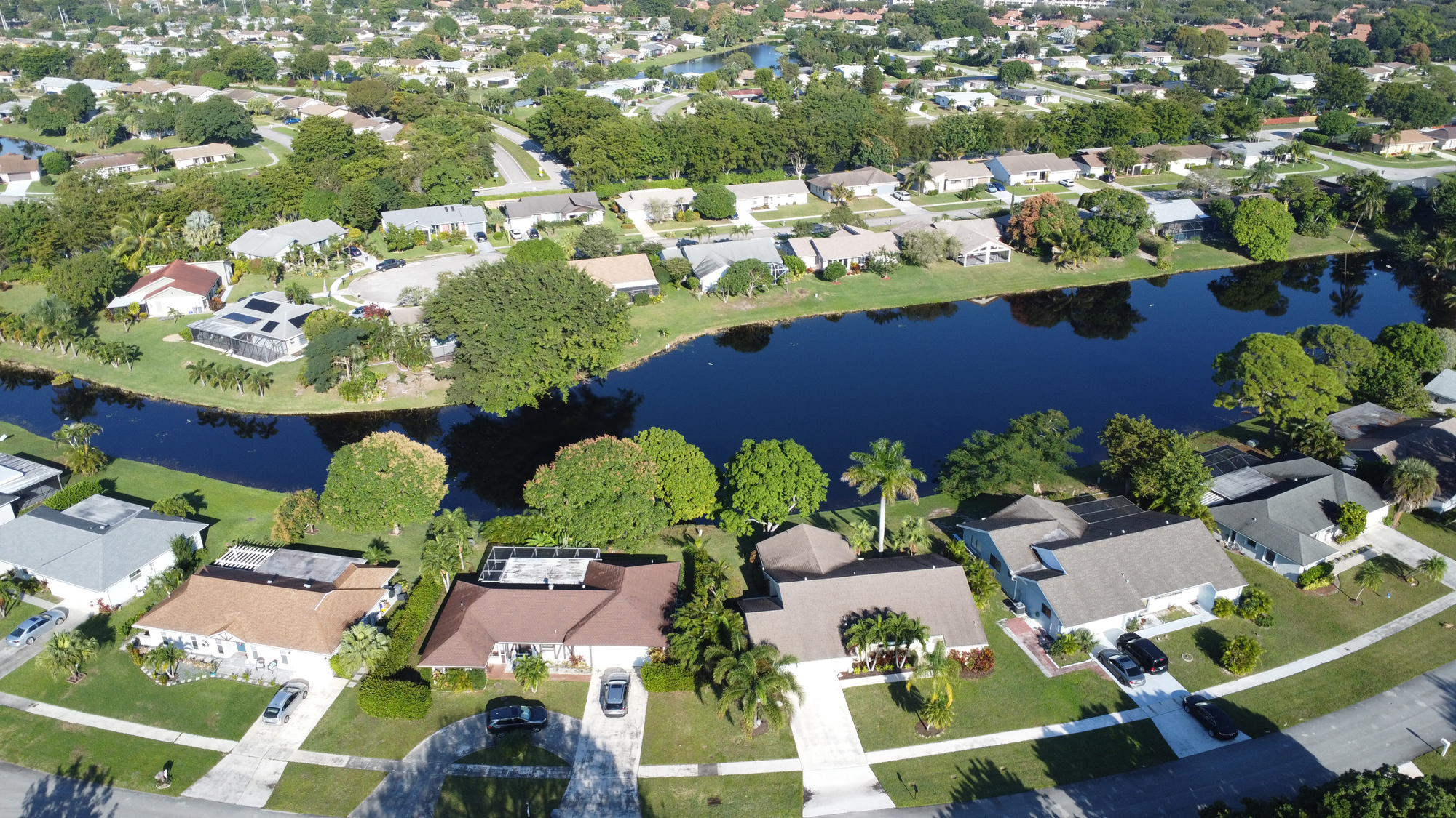
Pictures captired in December of 2025.
South Florida Water Management District
Preparing Year-Round
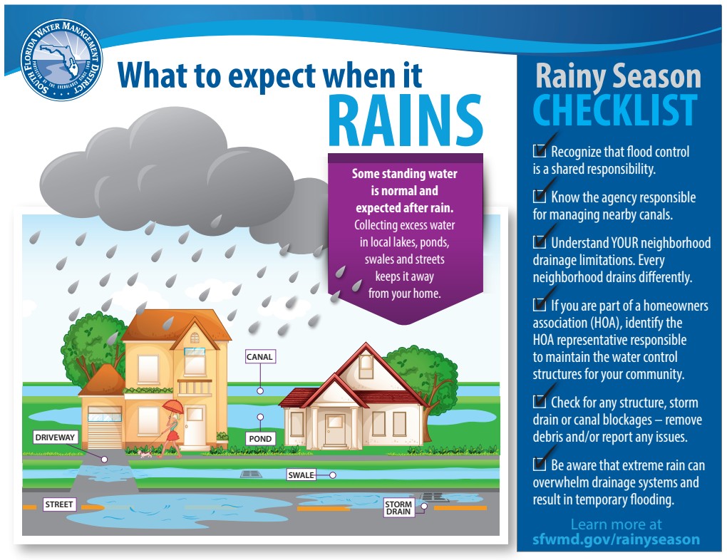
If you haven't lived in Florida for long, you may not know that our climate has two seasons: wet and dry. Flood and drought are frequent visitors, the result of too much or too little rain. In any year, drought can happen during the wet season, and flooding can occur when we least expect a downpour. Weather in South Florida has a way of ignoring the calendar and expectations of "normal."
A Shared Responsibility
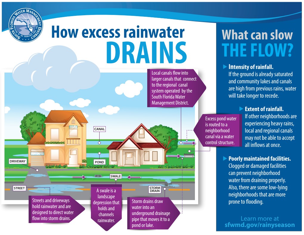
The South Florida Water Management District operates and maintains the regional water management system known as the Central and Southern Florida Project, which was authorized by Congress more than 75 years ago to protect residents and businesses from floods and droughts. This primary system of canals and natural waterways connects to community drainage districts and hundreds of smaller neighborhood systems to effectively manage floodwaters during heavy rain. As a result of this interconnected drainage system, flood control in South Florida is a shared responsibility between the District, county and city governments, local drainage districts, homeowners associations and residents.
Local (secondary) canal systems in South Florida are maintained and operated by cities, counties and water control districts – also known as 298 districts for the chapter of Florida Statutes that outlines their responsibilities. These secondary canal systems receive water from neighborhoods and store excess water or move it to the regional flood control system managed by the South Florida Water Management District.
You can access the South Florida Water Management District - Flood Control page here.
Lake Worth Drainage District (LWDD) Mapping Portal
This portal is the official source for data authored and stewarded by Lake Worth Drainage District. On this portal you will find data, maps, and applications that model elements of our infrastructure and depict important boundaries.
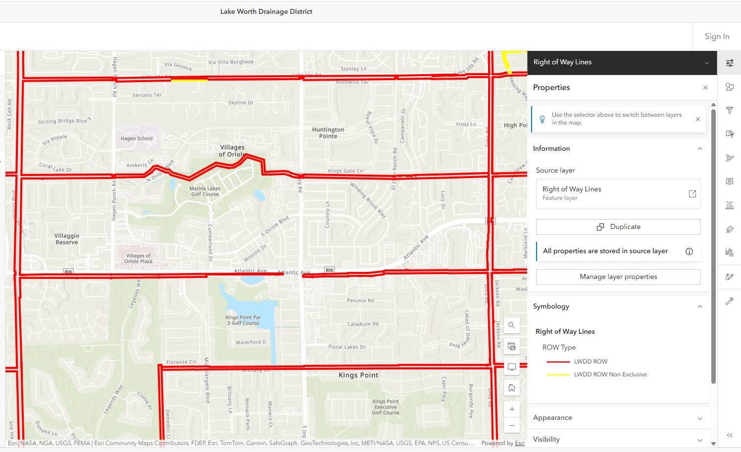
The Lake Worth Drainage District manages the water resources for much of southeastern Palm Beach County, FL, providing comprehensive flood control, water conservation and water supply protection for more than 700,000 residents and 10,000 acres of agricultural land. Their employees monitor and control a complex system of approximately 500 miles of canals and associated rights-of-way, 20 major water control structures and numerous minor structures.
Services provided by Lake Worth Drainage District include:
- Stormwater management and operation of the regional flood control system
- Permitting of structures discharging stormwater into District canals
- Maintenance of canals and rights-of-way
- Aquatic weed control
- Participation in community outreach and educational programs
The Lake Worth Drainage District encompasses approximately 200 square miles in southeastern Palm Beach County. They are bordered on the west by the Arthur R. Marshall Loxahatchee National Wildlife Refuge, on the east by Interstate 95, on the north by Okeechobee Boulevard and on the south by the Hillsboro canal.
Access the LWDD Mapping Portal here, or the Lake Worth Drainage District - Right of Way page here.
Flood Control In South Florida A Shared Responsibility
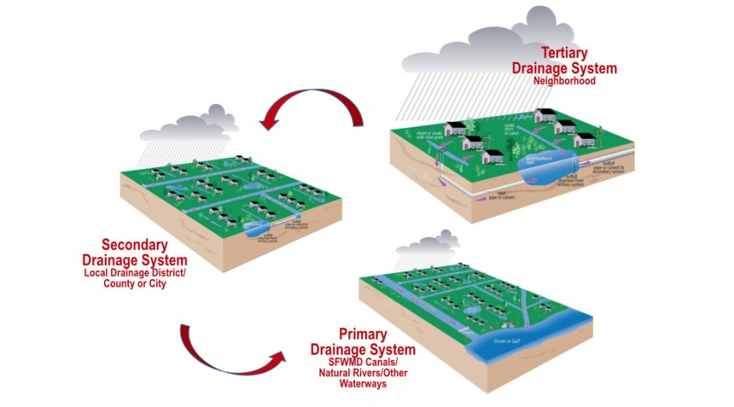
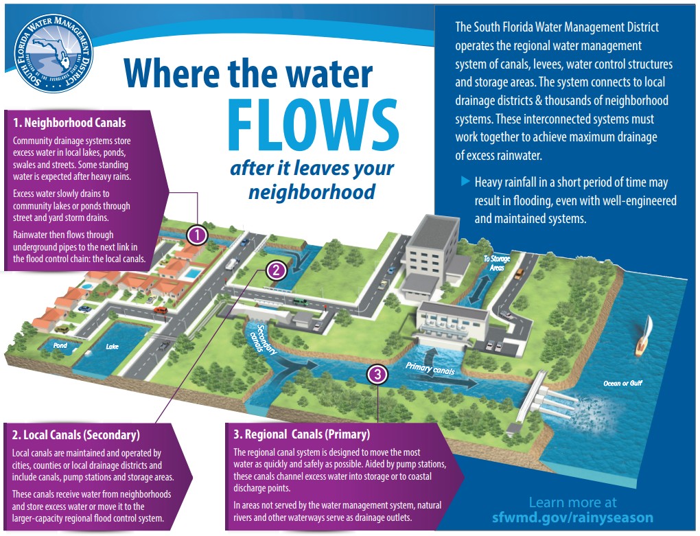
Flood control in South Florida is a shared responsibility and is achieved through an interconnected, three-tiered drainage system. Neighborhood drainage systems, or tertiary systems, are operated by property owners or residential associations. Secondary flood control canals are operated by the Lake Worth Drainage District, and primary flood control is provided by the South Florida Water Management District. The Lake Worth Drainage District works closely with the South Florida Water Management District before, during and after rainfall events to provide flood control for the residents of Palm Beach County. Water managers are continually monitoring weather systems and canal levels in order to proactively respond to heavy rainfall events. In anticipation of a heavy rainfall event, the Lake Worth Drainage District water control structures are opened in order to maintain appropriate water levels in the system. Residential communities are designed to retain water in swales and onsite detention ponds. With prior authorization from the Lake Worth Drainage District, excess stormwater may be discharged into District canals through control structures with fixed or operable weirs to prevent flooding of property.
View Lake Worth Drainage District's Flood Control offical page here.


Waterbody types
Florida is home to over 2.5 million acres of fresh water available in the form of lakes, rivers and streams, springs, man-made canals, and wetlands. Within these aquatic environments, invasive plants threaten native species and habitats, flood control structures, natural areas and resources, and recreation. Without management of invasive aquatic plants, boats would not be able to navigate, people could not safely swim, fish populations would be stunted or move elsewhere, bird populations would be threatened, tourists might go elsewhere, and agriculture crops and neighborhoods could be flooded during storm events.
Canals
Thousands of miles of canals, and their water control structures, are carved into Florida’s landscape, especially in the southeastern part of the state. Canals are artificial waterways that modify existing rivers or streams, or are dug into wetlands or uplands for navigation, drainage and flood control, irrigation, access, and recreation. Florida canals range from a few feet to hundreds of feet wide and from a few feet to as deep as 35 feet.
View UF|IFAS Center For Aquatic And Invasive Plants offical page here.